


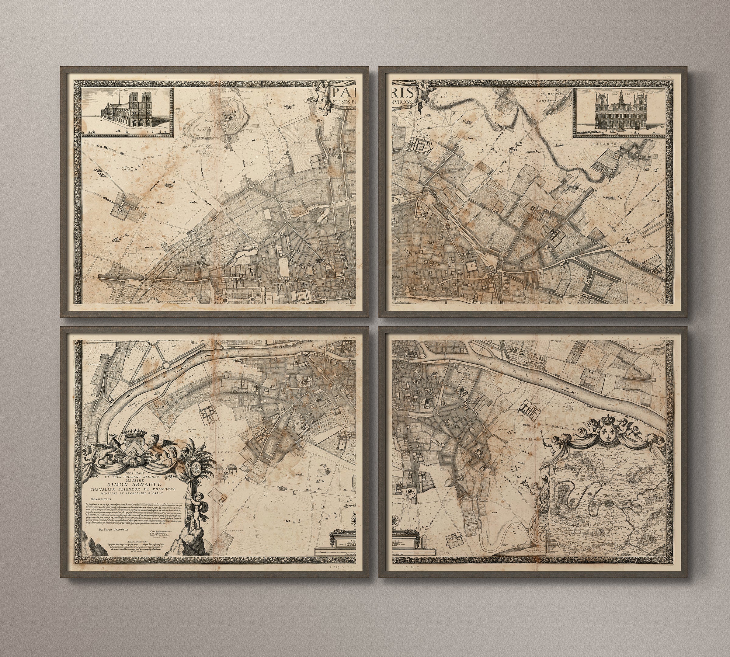
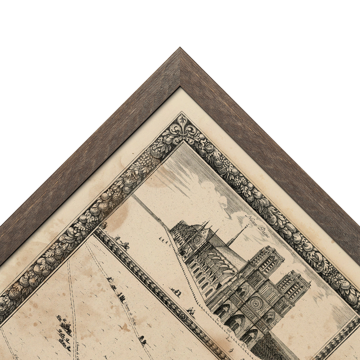
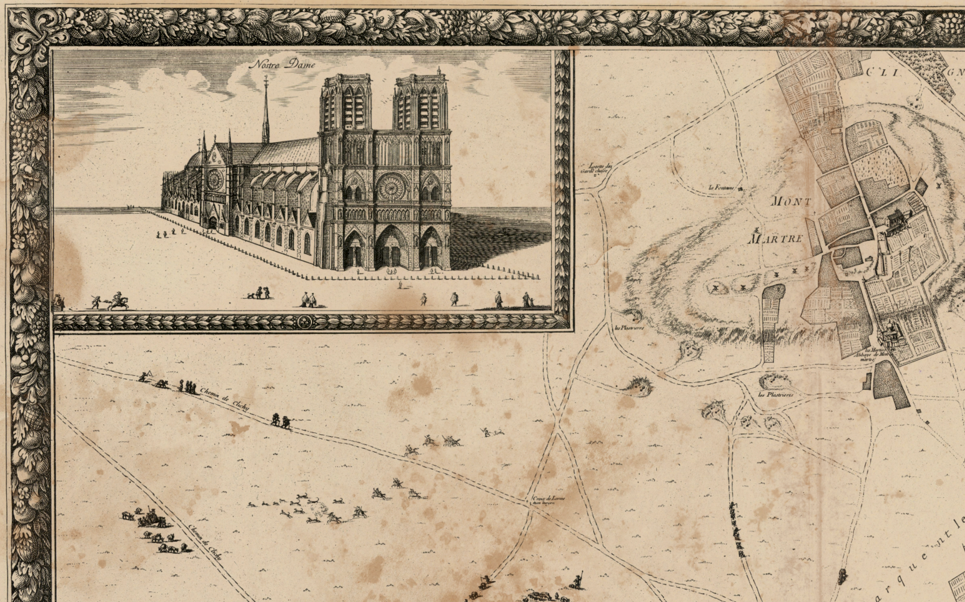
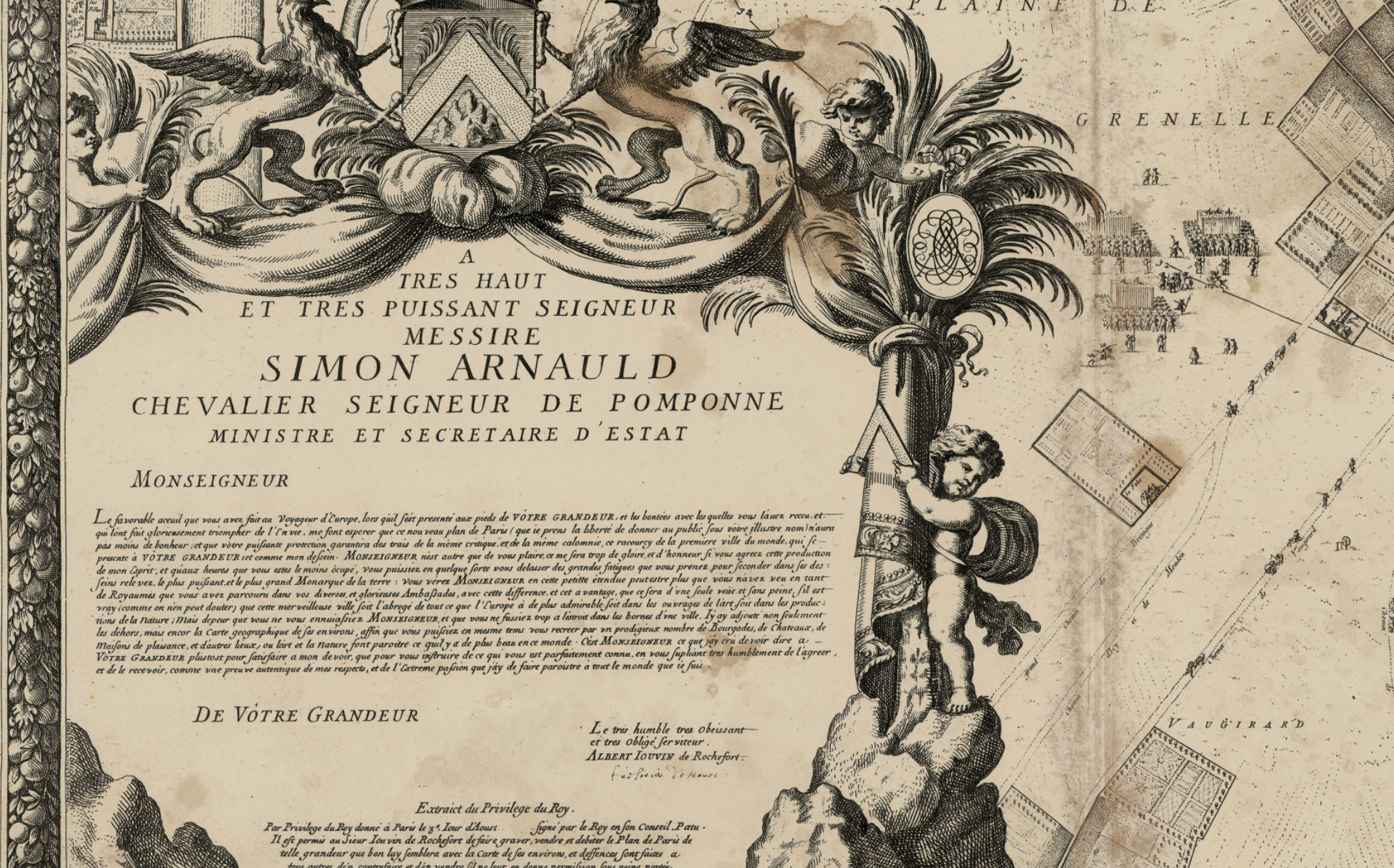
1672 Plan de Paris Four-Panel Map
- Regular Price
- $2,895.00
- Sale Price
- $2,895.00
- Regular Price
Sold Out
- Unit Price
- per
Free Shipping
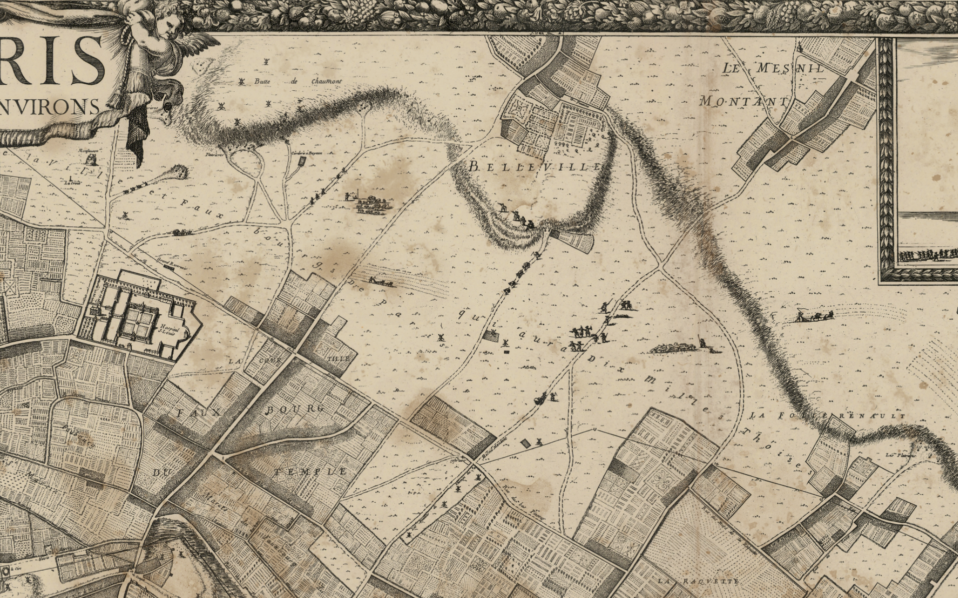
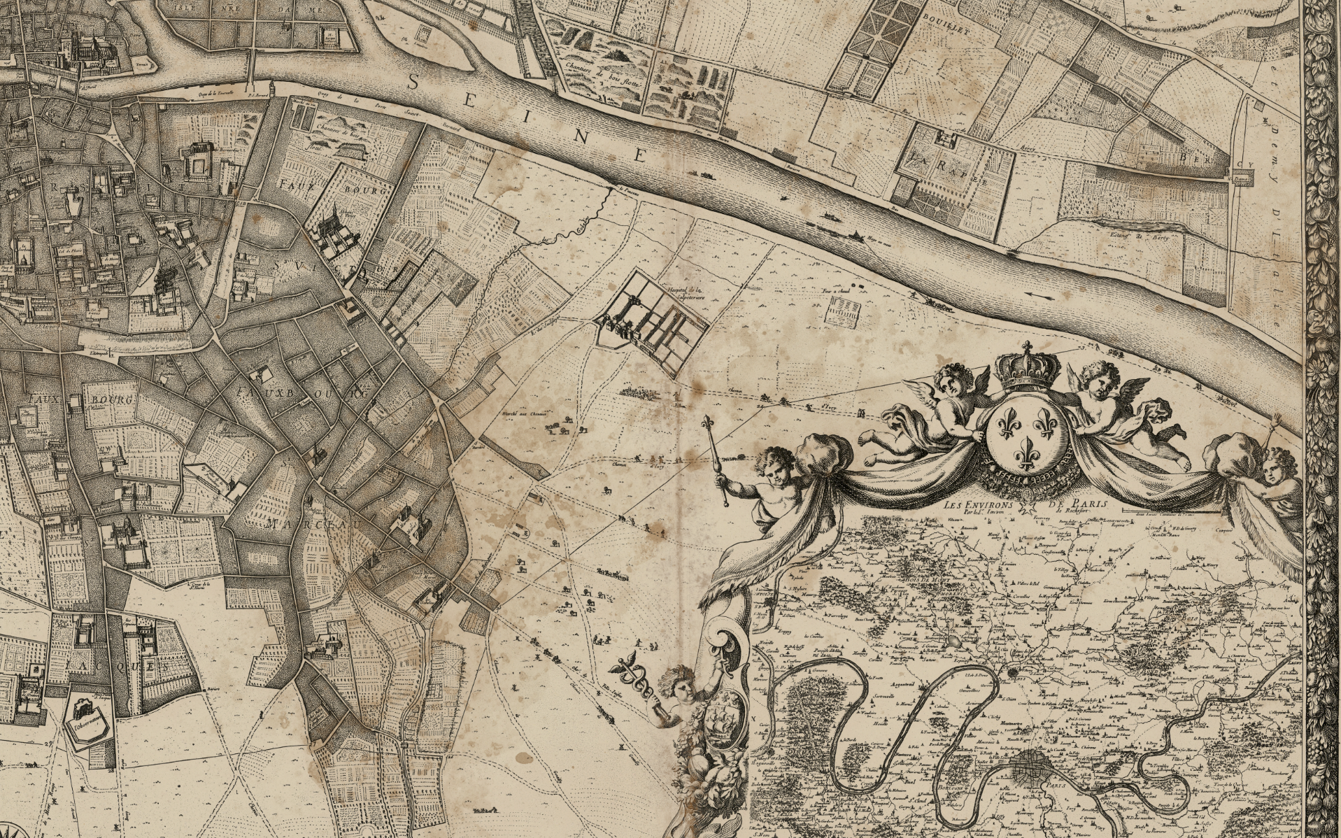
This impressive map of Paris was drawn in 1672 by French geographer Albert Jouvin de Rochefort, who rendered the city's thoroughfares and roads, parks, and rivers in incredible detail. Drawings of Notre Dame Cathedral and the Hotel de Ville were put in the higher corners, while Rochefort dedicated his gigantic work to Simon Arnauld, a well-known diplomat and ambassador to Sweden, in the lower left corner.